


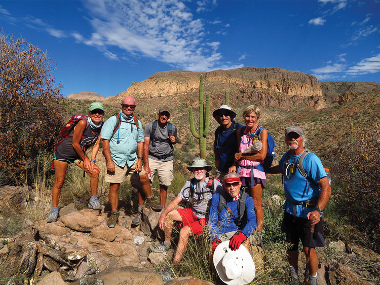
Kris Raczkiewicz, Neal Wring, Clare Bangs, Bob McDermott, Mike Tansey, Lynn Warren (photographer), Eileen Lords-Mosse, and Steve McElroy pausing along the trail in the heart of the Superstitions with impressive scenery in the background.
“A” Hike Adventure in the Superstitions
Lynn Warren
“A” hikes tend to be longer, harder, and more aggressive hikes, and on Nov. 8, eight PebbleCreek hikers left PebbleCreek at 5:30 a.m. for a challenging hike in the Superstitions. This hike lived up to “A” hike billing, since it took almost nine hours to complete this challenging but very scenic hike. One highlight was a scramble to Miner’s Summit, a mountain that rises above the impressive rock formation known as Miner’s Needle and provides an impressive, 360-degree view of the interior of the Superstitions. A lowlight, however, was having to hike on some very rocky trails and creek beds, some overgrown with catclaw acacia, also known as “Wait-a-Minute Bush.” These bushes may be chest high and are loaded with tiny, very sharp, curved spines that can easily snag a hiker’s skin. If you have experienced this, you know why you “wait a minute.” In spite of a few challenges, the hikers enjoyed a 15-mile hike with 2,700 ft. of elevation gain, which combined Dutchman, Whiskey Springs, Red Tanks, and Bluff Springs trails. The hike included stops at Whiskey Springs and La Barge Springs (including a touch of fall color), areas not normally seen on day hikes. Join the hiking club and experience the excitement of visiting interesting areas that you might not tend to visit on your own. The club offers hikes six days a week to interesting places and features around the Valley and beyond; visit the club website at pchikers.org for more information and photos.
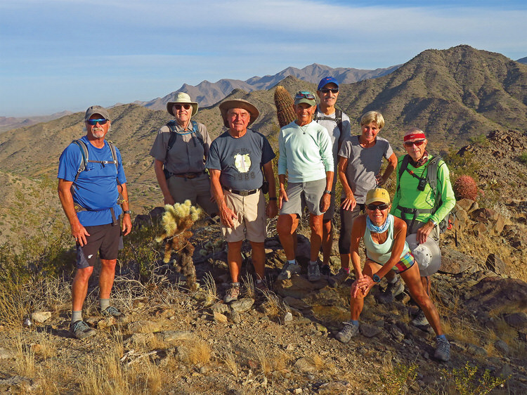
Steve McElroy, Dana Thomas, Lyman Gallup, Marilyn Reynolds, Mike Tansey, Kris Raczkiewicz, Eileen Lords-Mosse, and Lynn Warren (photographer) pausing to enjoy the views from Skyline’s Pyrite Summit.
“B” Hikers Enjoy Views on Pyrite Summit
Lynn Warren
November’s weather was very conducive to hiking, and on Nov. 24, eight PebbleCreek hikers visited Buckeye’s nearby Skyline Park and, to ensure a healthy appetite for the following day, enjoyed an energetic and scenic 10-mile, 1,500-foot, pre-Thanksgiving hike to the summit of Pyrite. The hikers did this hike in a clockwise direction from the trailhead, since the climb up would be longer but less steep. From the summit, they enjoyed impressive views of the park and surrounding areas, including plumes from the Palo Verde Generating Station. The Hiking Club offers hikes six days a week at four levels of difficulty. Visit the club website at pchikers.org for more information and photos.
 Tom’s Thumb Hike
Ruth Bindler
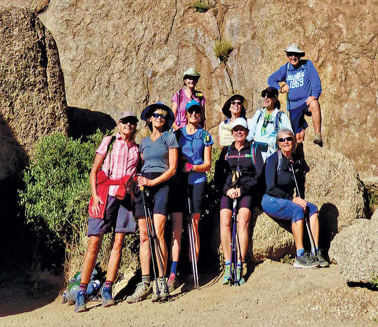
It was a record-breaking warm temperature on Dec. 1, reaching the low 80s. Nine hikers from the PebbleCreek Hiking Club took advantage of the perfect day to complete the 6-mile, 1,400 foot elevation gain hike to the foot of Tom’s Thumb. The McDowell Sonoran Preserve comprises 30,000 acres and eight trailheads in Scottsdale with a wide variety of trails, and Tom’s Thumb is in the central preserve. The hiker ascends with views of the Four Peaks, Weaver’s Needle, and Fountain Hills. The Hiking Club sponsors a number of hikes each week from four to 12 miles in Maricopa County and beyond. Club meetings are on the third Thursday of each month; prospective members can attend to learn about hiking in the desert and the offerings of the club. The PebbleCreek Hiking Club website at pchikers.org fully describes the activities of the club, future hikes, hiking safety, and more.
 Granite Mountain Hotshots Memorial Hike
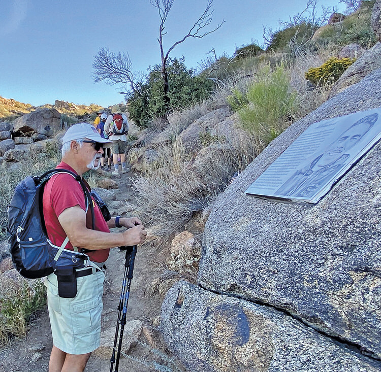
Would you hike 7.5 miles with 1,750 feet of elevation gain? The PebbleCreek Hiking Club members did in order to visit the Granite Mountain Hotshots Memorial. In June 2013, while fighting the Yarnell Hill Fire, 19 firefighters lost their lives. Along the trail, you will see interpretive signs and memorial plaques sharing a photo and story of each fallen Hotshot. Interpretive signs outline the tragic events of the Yarnell Hill Fire. This trail is a moving tribute to the 19 Hotshots who lost their lives. Neither speed, mileage, nor elevation gain was forefront in the hikers’ minds as they retraced the steps of the 19 fallen firefighters.
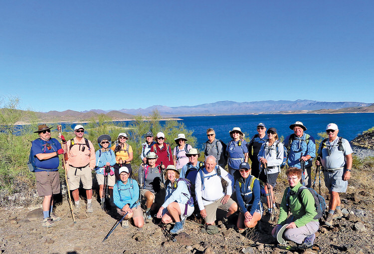 Hiking at Lake Pleasant
Ruth Bindler
On a sunny, breezy Friday just after Thanksgiving, 21 vigorous hikers walked off some of the previous day’s feast. It was a perfect day for a 7.4-mile hike at Lake Pleasant Regional Park on the Beardsley, Frog Tank, and Roadrunner trails. The hikers paused for a snack at the Nature Center and passed by the playground with Gila monster and bald eagle climbing structures. There are many trails at Lake Pleasant Regional Park (part of the Maricopa County Park System) for a variety of hiking adventures; burros, osprey, and other wildlife are frequently seen. The hiking club organizes a variety of hikes each week, with variations in distance, elevation gain, and pace. Attending a club meeting on the third Thursday evening of each month and visiting the pchikers.org website are good ways to learn more about the club.