

Hiking Lake Pleasant Regional Park
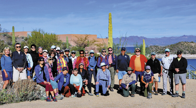
Front row: Sandy Mednick, Barb Kripps, Kris Raczkiewicz, Mary Hill, Laurie Rosenbloom (co-coordinator), Dorothy Sammartino, Ranger Shaun, Ruth Bindler; back row: Nancy Love, Diana Bedwell, Jan Sherwood, Laurie Malatesta, Ken Moorefield, Nadine Eder, Susan Bernt, Jay Eisenbeis, Dave Schuldt, Freddie Wilson, Jo Hatfield, Dennis Zigmunt, Malinda Jensen, Nancy Swanson, Kathlenn Brown, Martha Hadden, Coedy Hadden, Dan Sammartino, Art Solario, Neal Wring, Steve McElroy (co-coordinator), Tom Wick (photo by Ruth Bindler)
Ruth Bindler
One of the West Valley’s favorite areas for hiking is the Lake Pleasant Regional Park. It straddles Maricopa and Yavapai counties and contains a 10,000-acre lake created in 1927 by the Carl Pleasant Dam. The lake originally received its water from the Agua Fria River, and in 1973, with the construction of the Central Arizona Project Aqueduct, the Colorado River became the main source of water stored in this reservoir. Finally, in 1994, the Waddell Dam was completed, and replaced the original 1927 structure. The park itself covers 23,000 acres and supports mountain biking, hiking, fishing, boating, and camping activities.
PebbleCreek hikers commonly visit the park and recently participated in a ranger-led hike on two trails that are not open to the general public. We learned that the green leaves of the ocotillo are edible, having a tart taste in early morning followed by a sweeter taste when the sun facilitates sugar production in the late afternoon. Ranger Shaun even ate a cactus fruit, shared information on why cholla cactus spines are hard to remove from boots and skin, and led us along hikes with views of the lake, burros, green desert floor, and soaring birds. If you want to learn more about hiking in the desert, visit the website pchikers.org.
Hiking at Saddle Mountain
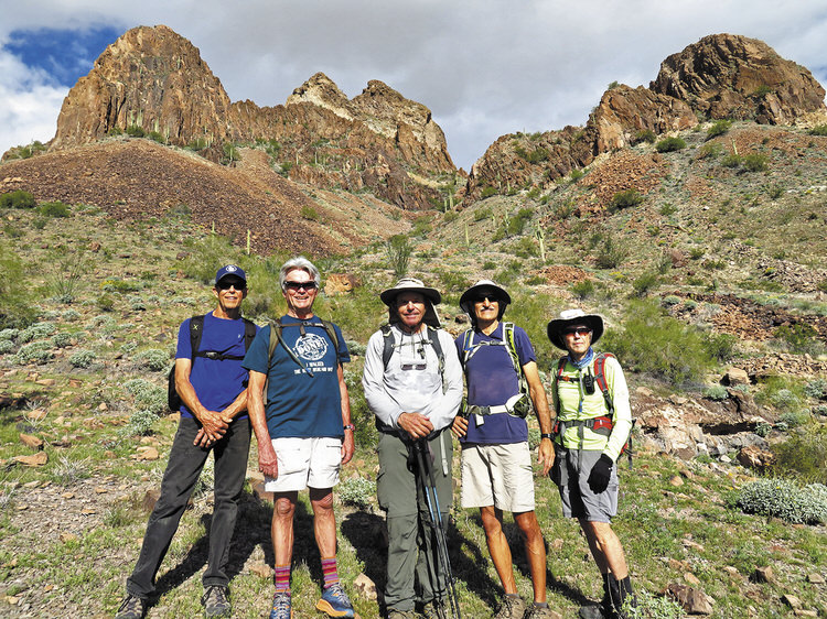
Left to right: Roger Davis, Gary Bray, Tom O’Reilly, Mike Tansey, and Lynn Warren (photographer) pausing in early morning light on the south side of Saddle Mountain with impressive rock formations in the background.
Lynn Warren
The odd-shaped mountain with a big dip in the middle south of I-10 at Tonopah is known as Saddle Mountain. On Feb. 28, five “B” hikers completed a 6.7-mile clockwise loop on this mountain, which has rugged, impressive scenery. Although a short hike in distance, this hike is one of the most scenic but at the same time rugged hikes that the club undertakes. Roughly two-thirds of the hike is either a primitive trail or open bushwhacking. The middle one-third is very challenging because of the steep slope, which you must descend from the “dip” you see from I-10; this descent is challenging because of the steepness, loose material, rocks, and thick undergrowth. Although Saddle Mountain can appear quite desolate in summer, because of recent rain, the slopes were quite green and poppies were beginning to bloom, enhancing an already scenic hike. Why not join the hiking club and you, too, can enjoy interesting and scenic areas like this with a great group of people; visit the club website at pchikers.org for more information and photos.
How Many People Usually Go on a Hike?
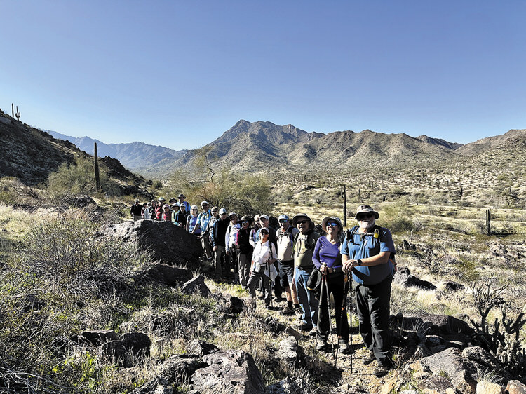
This large group of smiling hikers includes: Art Solorio, Charlene Elijew, Fred Nix, John Chrusciel, Diane Chrusciel, Jim Pickett, Lila Aigner, Atsuko Arner, Jo Hatfield, Jay Eisenbeis, Mary Hill, Tom Wellman, Linda Schmillen, Nadine Eder, Steve Duncanson, Jennifer Kwong, Wayne Wills, JoAnn Cohn, Bob Sinclair, Kay Thomas, Freddie Wilson, Barb Kripps, Tom Wick, Alex Elijew, and Jan Sherwood (photographer).
Jan Sherwood
The question is often asked, “How many people go on a hike?” In prior club hiking photos, you may see as few as four and at times more than 20. Typically the hike participants are somewhere in the teens. When the group is as large as the one in this photo, three walkie-talkies (like the yellow one Art is wearing) are used: leader, middle, and sweep. The walkie-talkies are used to alert us of horses, bikers, and other hikers, as well as animals, flowers, and interesting rock formations.
Why was this group so large? The hike took place in nearby Estrella Mountain Regional Park in perfect hiking conditions. Did you know that Estrella Mountain Regional Park was the first regional park in the Maricopa County Regional Park System? It was established in 1954 at 828 acres. Today it covers 19,840 acres of mostly pristine desert with 33 miles of trails. Although it is a multi-use park, hiking makes up 74% of the usage. The PebbleCreek Hiking Club has weekly hikes here adding to that usage percentage.
Notice the greening of the desert in the photo—wildflowers are starting. Join the club on one of the upcoming hikes by visiting pchiikers.org for information.