

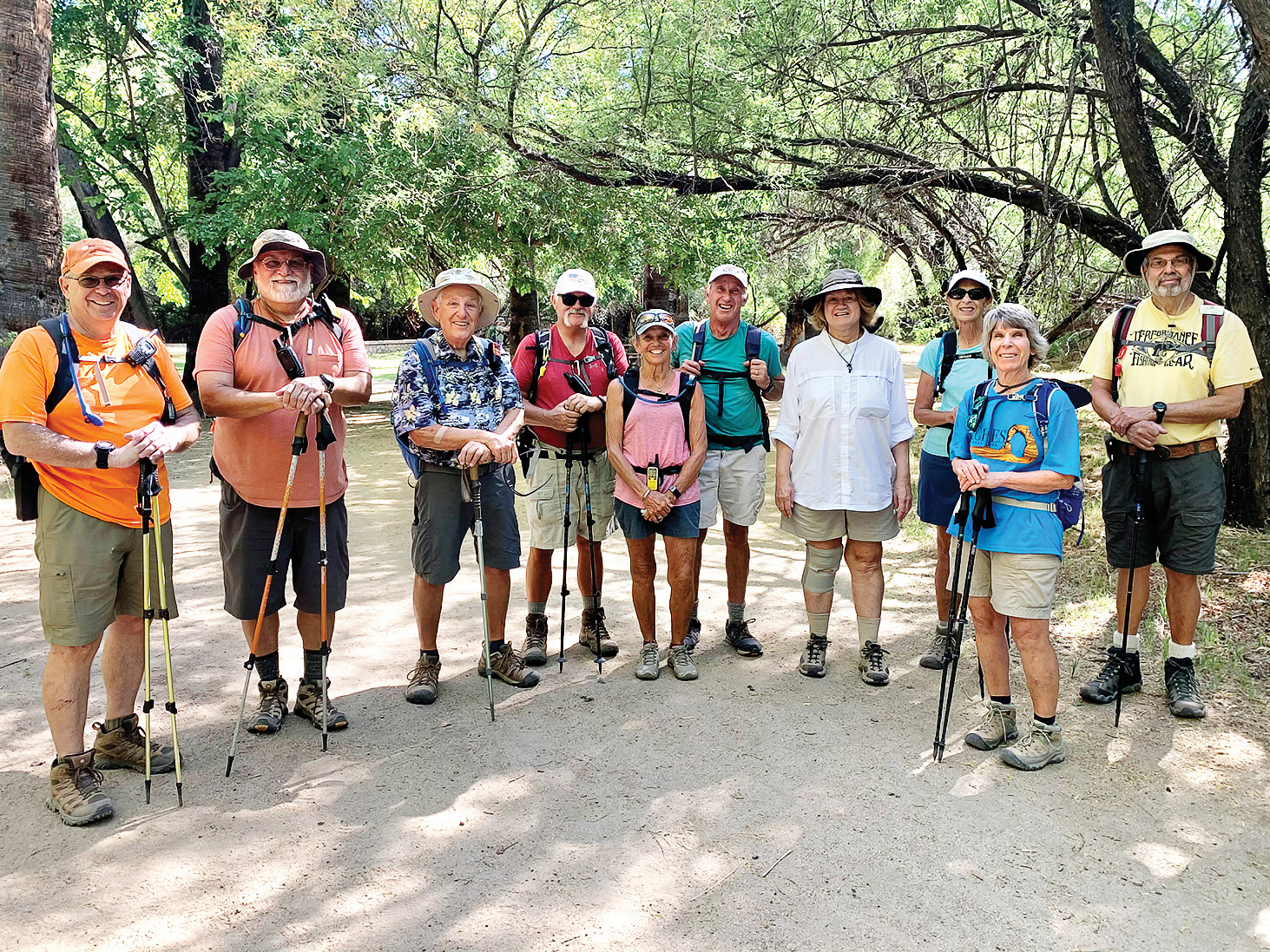
Tom Wick, Art Solorio, Dennis Zigmunt, Dave Schuldt, Marilyn Reynolds, Clare Bangs, Bonnie Kasel, Jan Sherwood, Barb Kripps, and Gary Baker
Hikers Visit Hassayampa River Preserve
Jan Sherwood
Just south of Wickenburg on Highway 60, you’ll find the Hassayampa River Preserve. Ten members of the PebbleCreek Hiking Club enjoyed walking under the trees along the river on the looping trails. The trails there are mostly rated easy (elevation gain of at most 14 feet), with just one trail to the lookout (elevation gain of 104 feet), making this a perfect area for visiting family, beginners, and seasoned hikers. Bird watchers will enjoy the preserve, as there have been 294 bird species found here. To join on future fun hikes like this, check out our website at pchikers.org.
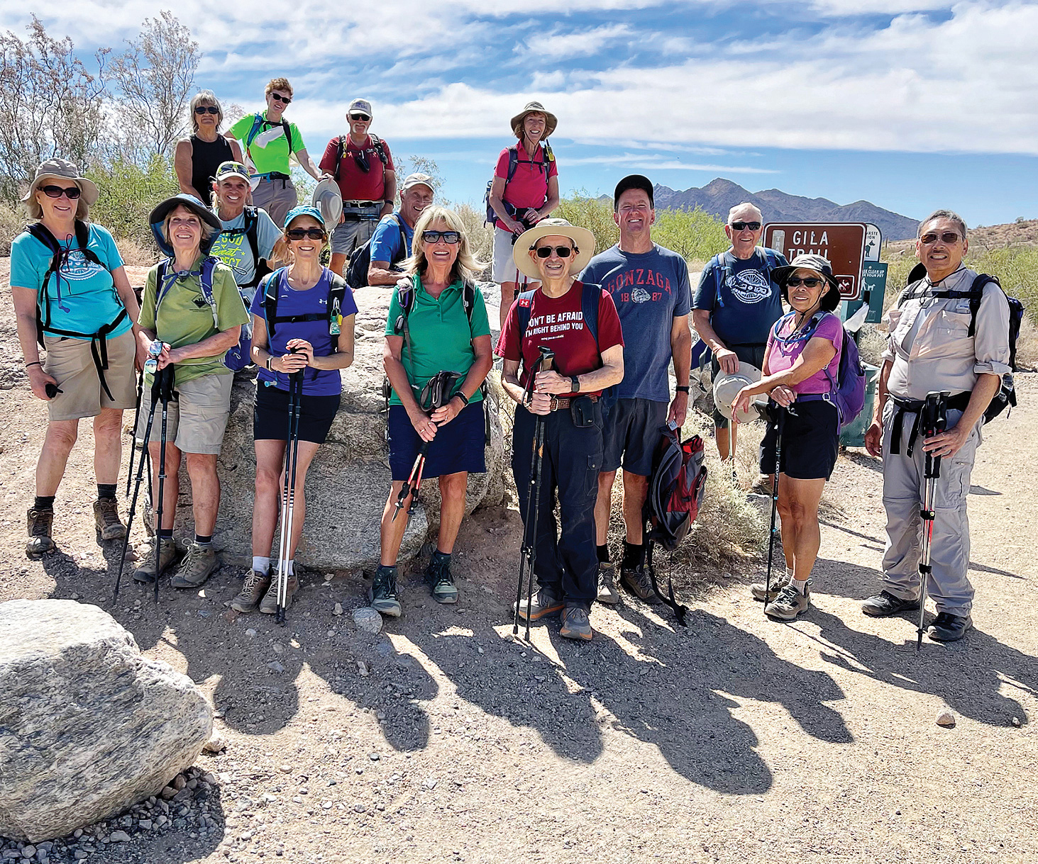
Left to right: Linda Schmillen, Barb Kripps, Marilyn Reynolds, Pat Wilson, Sandy Mednick, Pam Marshall, Dave Schuldt, Clare Bangs, Nancy Love, Ann Rohlman, Pete Williams, Kerry Walsh, Dennis Zigmunt, and Bev and Ed Kim (Photo by Dana Thomas)
PebbleCreek Hiking Club: April 28 Hike
Dana Thomas
The Hiking Club has hikes scheduled every week year-round, although there are fewer hikes and hikers during the summer. The hike on April 28 had some snowbirds who depart by mid-May, so we will not see them until they return in the fall.
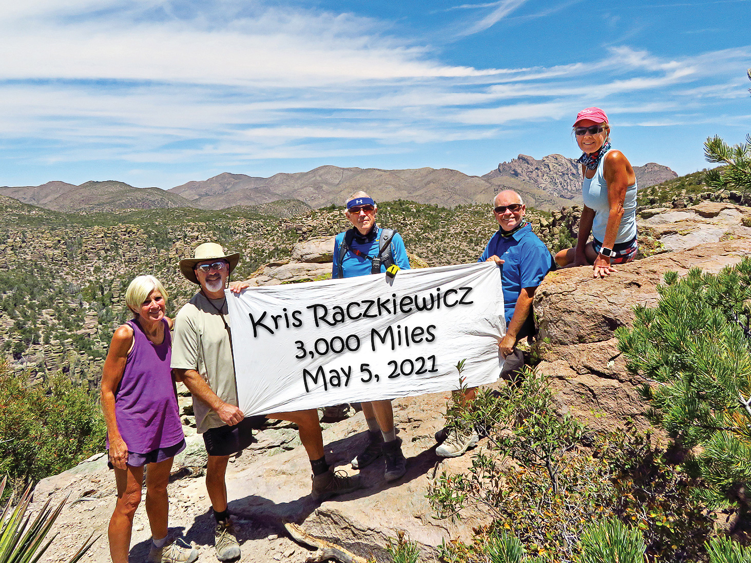
Left to right: Eileen and Leon Mosse, Lynn Warren (photographer), Neal Wring and Kris Raczkiewicz pause on Inspiration Point (with Cochise Head in the background) in the Chiricahuas to celebrate Kris’ achievement.
Hikers Explore McDowell Sonoran Preserve
Jan Sherwood
Scottsdale’s McDowell Sonoran Preserve is the largest urban preserve in the nation, and it’s just a short drive northeast of Phoenix. Twenty-one members of the PebbleCreek Hiking Club enjoyed the Cathedral and Balanced Rock Trails on a pleasant, partially cloudy day. The preserve has 11 trailheads and was the result of a group of Scottsdale residents forming a trust (now a conservancy) to save the McDowell Mountains and surrounding desert from development. Along with the unique granite rock formations, the preserve is rich in plant and animal life (on that day’s hike we saw a bobcat!). While social distancing on the trail, we gathered briefly for the group photo at Balanced Rock. The regular hiking season is coming to an end, but there will be summer hikes that leave very early in the mornings. For more information and to join us on a hike, visit pchikers.org.
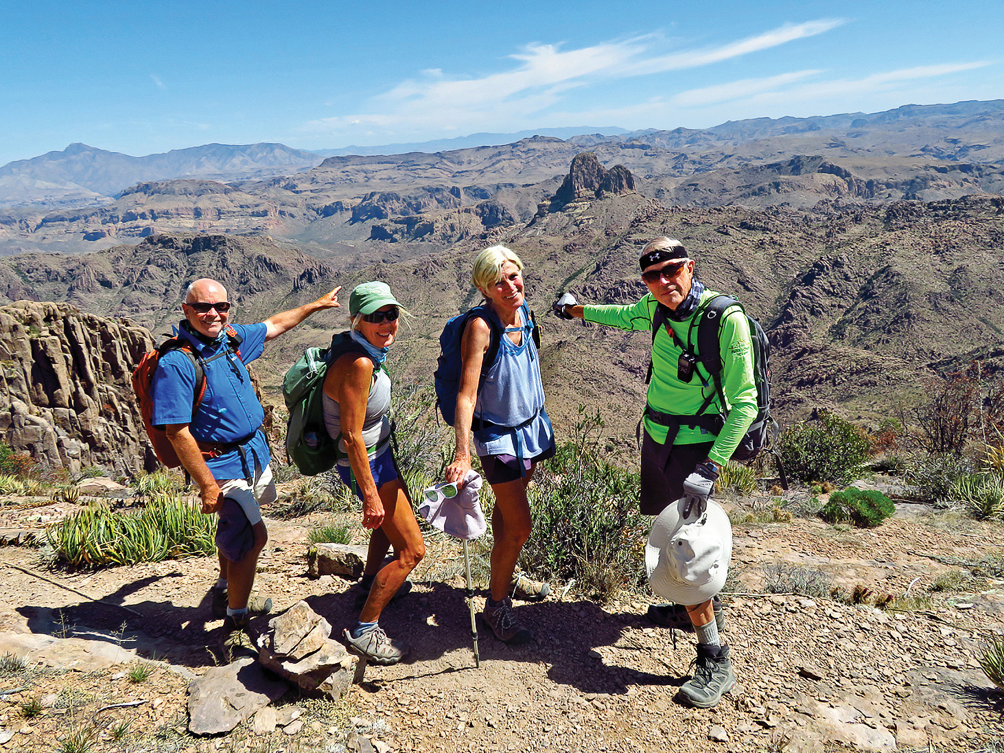
Left to right: Neal Wring, Kris Raczkiewicz, Eileen Lords-Mosse, and Lynn Warren (photographer) pausing near the base of Superstition Peak with Weaver’s Needle far below.
Hikers Finish Season on Superstition Ridge
Lynn Warren
“A” hikers undertake longer and more difficult hikes, and on April 12, four hikers left before dawn and staged a car at Lost Dutchman State Park at the north end of the Superstitions before driving in a second car to the south end to begin the difficult Superstition Ridge hike. The hike began with a steep climb up Carney Springs Trail to the ridgeline, followed by a long, frequently challenging hike north along the ridge, eventually reaching iconic Flatiron late in the afternoon. After a short break on Flatiron, the hikers then descended the challenging trail to the car left at Lost Dutchman. It was a long day, and the hikers were tired but had a great feeling of satisfaction after completing the 14-mile hike with 4,600 feet of elevation gain. They had to agree with reports that this likely is the most difficult hike in the Phoenix area and a fitting end-of-season “A” hike.